
Inca Trail Map: Route, Campsites and Elevation Profile
By the Goo Machu Picchu team · Checked against official sources (editorial policy) · Updated October 2026 · 4 min read
The Classic Inca Trail map runs about 26 miles (42 km) from Km 82 (Piscacucho) on the Urubamba River to Machu Picchu, crossing three passes and around a dozen Inca sites. Elevation ranges from about 8,900 feet at the trailhead to about 13,800 feet at Dead Woman's Pass, then drops to Machu Picchu at about 7,970 feet.
This guide walks the map point by point with campsites, ruins and elevations so you can picture each day.
- Start
- Km 82, Piscacucho (about 8,900 ft)
- Finish
- Machu Picchu via the Sun Gate (about 7,970 ft)
- Passes
- Dead Woman's, Runkurakay, Phuyupatamarca
- Highest point
- About 13,800 ft (4,215 m)
- Main campsites
- Wayllabamba, Pacaymayo, Wiñay Wayna
- Short route start
- Km 104 (Chachabamba)
Inca Trail Route Map at a Glance
The Inca Trail follows the Urubamba valley from Km 82, turns up the Cusichaca and Llulluchapampa valleys to Dead Woman's Pass, crosses two more passes along the ridge, then descends through cloud forest to Wiñay Wayna and the Sun Gate above Machu Picchu.
The simplified map shows the order of passes and campsites. It is illustrative and not to scale; use it to understand the shape of the trek, not for navigation. Licensed guides lead every group, so you will not need to navigate yourself.
Many travelers read our Salkantay trek difficulty guide next.
Elevation figures make more sense alongside our Inca Trail difficulty guide and the general Machu Picchu elevation guide. If the classic trail is full, compare it with the Inca Trail vs Salkantay comparison or check Inca Trail permit availability.
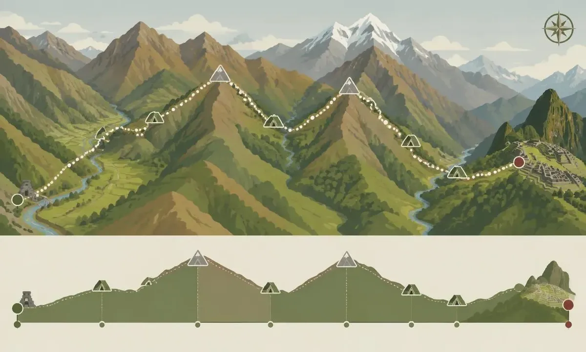
Inca Trail Elevation Profile
The Inca Trail elevation profile climbs from about 8,900 feet at Km 82 to about 13,800 feet at Dead Woman's Pass on day 2, then crosses Runkurakay (about 12,950 ft) and Phuyupatamarca (about 12,100 ft) on day 3 before dropping to Wiñay Wayna (about 8,700 ft) and Machu Picchu (about 7,970 ft).
| Point on the map | Approx. elevation | Day |
|---|---|---|
| Km 82, Piscacucho trailhead | 8,900 ft (2,720 m) | 1 |
| Llactapata (Patallacta) ruins | 8,700 ft (2,650 m) | 1 |
| Wayllabamba | 9,800 ft (3,000 m) | 1 |
| Llulluchapampa | 12,450 ft (3,800 m) | 1 or 2 |
| Dead Woman's Pass (Warmiwañusqa) | 13,800 ft (4,215 m) | 2 |
| Pacaymayo campsite | 11,800 ft (3,600 m) | 2 |
| Runkurakay Pass | 12,950 ft (3,950 m) | 3 |
| Sayacmarca ruins | 11,800 ft (3,600 m) | 3 |
| Phuyupatamarca | 12,100 ft (3,680 m) | 3 |
| Wiñay Wayna | 8,700 ft (2,650 m) | 3 |
| Sun Gate (Inti Punku) | 8,900 ft (2,720 m) | 4 |
| Machu Picchu | 7,970 ft (2,430 m) | 4 |
Elevations are rounded from commonly published figures and vary by about 100 to 300 feet between sources. Total climbing over the trek is roughly 6,000 to 7,000 feet. How hard that feels is covered in our Inca Trail difficulty guide.
Inca Trail Campsites on the Map
Inca Trail campsites are assigned by the park, not chosen freely. Day 1 camps are usually at or above Wayllabamba, day 2 camps at Pacaymayo or Chaquicocha, and the last night at or near Wiñay Wayna, about 3.5 miles from Machu Picchu.
Camping higher on night 1 (such as Llulluchapampa) makes day 2 shorter but means a colder night. Camping closer to Wiñay Wayna on night 3 makes the dawn walk to the Sun Gate easier. Your operator confirms campsites when the permit is issued.
Ruins Along the Inca Trail Map
Main ruins along the Inca Trail map are Llactapata (Patallacta), Runkurakay, Sayacmarca, Phuyupatamarca, Intipata and Wiñay Wayna, before the Sun Gate and Machu Picchu itself. Most of these Inca sites are only reachable on foot, which is a big reason hikers choose this route over the train.
- Llactapata (Patallacta): large terraced site seen early on day 1.
- Runkurakay: small round structure below the second pass, thought to be a rest stop.
- Sayacmarca: compact hilltop site with dramatic cliff views.
- Phuyupatamarca: "town above the clouds" with ceremonial baths.
- Intipata and Wiñay Wayna: huge terraced hillsides near the last campsite.
- Inti Punku: the Sun Gate above Machu Picchu, your first view of Machu Picchu.
Short Inca Trail Map
The Short Inca Trail starts at Km 104 (Chachabamba, about 6,900 ft), climbs to Wiñay Wayna and joins the classic route to the Sun Gate and Machu Picchu. It covers about 7.5 miles in one day, with a top elevation near 8,900 feet.
Because it shares the final stretch, you still enter Machu Picchu through the Sun Gate. Details and booking are on our Short Inca Trail 2 days page.
How the Inca Trail Map Connects to Cusco
From Cusco, groups drive about 2 hours to Ollantaytambo and Km 82 to start. After the trek, hikers take the bus down to Aguas Calientes and the train back to Ollantaytambo or Cusco, so the trail is a one-way route.
See our Machu Picchu train guide for the return and the Machu Picchu map for the layout of the citadel once you arrive. Ready to walk it? See the Classic Inca Trail 4 days.
Frequently asked questions
Where does the Inca Trail start?
The Classic Inca Trail starts at Km 82, a checkpoint called Piscacucho on the railway line beyond Ollantaytambo, about a 2-hour drive from Cusco. Hikers show their passport and permit there before crossing the Urubamba River. The Short Inca Trail starts further along the railway at Km 104, near the Chachabamba ruins.
What is the highest point on the Inca Trail map?
The highest point on the Inca Trail map is Dead Woman's Pass (Warmiwañusqa), at about 13,800 feet (4,215 m), reached on the morning of day 2. The name comes from the shape of the ridge, said to resemble a reclining woman. Expect cold wind at the top, so keep a warm layer handy.
Can I download an Inca Trail map?
You do not need to download an Inca Trail map to navigate, because a licensed guide leads every group and independent hiking is not allowed. Our illustrated map is for planning only and is not to scale. Most operators share a route sheet with campsites and daily distances once your permit is confirmed.
How much elevation gain is on the Inca Trail?
The Classic Inca Trail has roughly 6,000 to 7,000 feet of total elevation gain over 4 days, with a similar amount of descent. The biggest single climb is about 3,900 feet on day 2, from the valley to Dead Woman's Pass. Days 3 and 4 involve more downhill, which is often harder on knees.
Is the Inca Trail on AllTrails or Google Maps?
Parts of the Inca Trail appear on AllTrails and Google Maps, but recorded tracks differ in length and campsite positions. Treat them as a rough picture of the route only. Because Peru allows no independent hiking, your licensed guide handles navigation, and official campsite assignments come with the permit, not from a mapping app.
Want help picking your Inca Trail route?
Send your dates and we will check permit availability for the classic or short route. Prefer to read first? Get the free Machu Picchu trip guide.
Sources checked October 3, 2026
Recommended tours
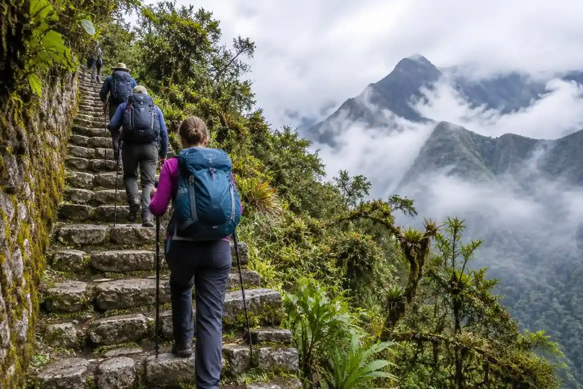
Inca Trail · 4 days
Classic Inca Trail to Machu Picchu, 4 Days
The world-famous 43 km trek on original Inca stone paths, ending at the Sun Gate.
from $827
View tour →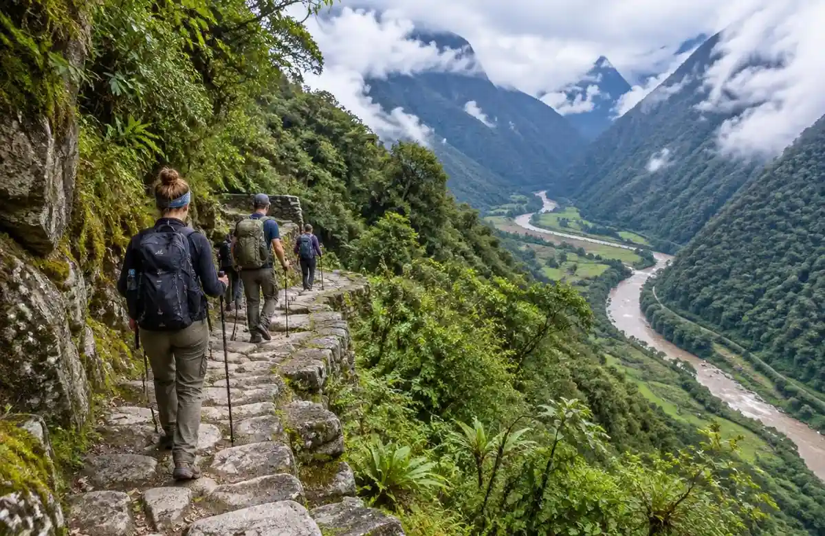
Inca Trail · 2 days
Short Inca Trail to Machu Picchu, 2 Days
The final 12 km of the Inca Trail, Sun Gate arrival and a night in Aguas Calientes.
from $489
View tour →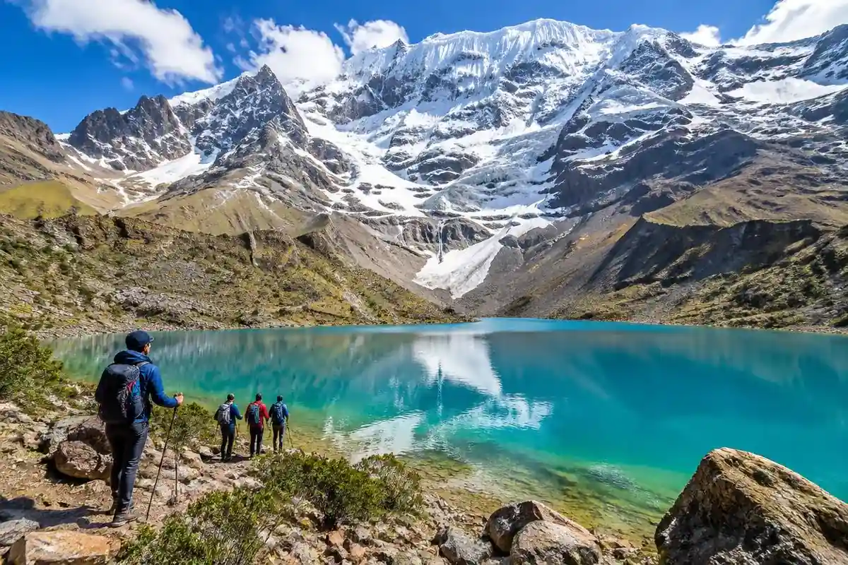
Treks · 5 days
Salkantay Trek to Machu Picchu, 5 Days
The best alternative to the Inca Trail: Humantay Lake, a 4,630 m pass and cloud forest.
from $490
View tour →Keep planning
- Inca Trail Permits: How to Get One, Daily Limits and Availability
- Inca Trail Difficulty: How Hard Is the Inca Trail, Really?
- Inca Trail vs Salkantay Trek: Which Should You Choose?
- Machu Picchu Tickets 2026: Prices, Ticket Types and How to Buy
- Best Time to Visit Machu Picchu: Best Months, Seasons and Time of Day
- How to Get to Machu Picchu: Every Route From Cusco Compared
- Machu Picchu Bus: How the Shuttle From Aguas Calientes Works
- Machu Picchu Hotels: Best Places to Stay Near the Citadel by Area and Budget