- Duration
- 5 days
- Difficulty
- Challenging
- Max altitude
- 5,200 m
- From
- $640 pp
Quick answer
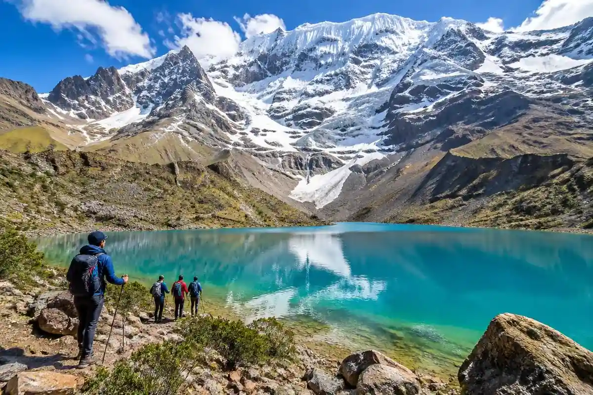
The Ausangate trek is a 5-day camping circuit around Mount Ausangate (6,384 m / 20,945 ft), the highest peak in the Cusco region of Peru. The route covers about 60 km from Tinki and Upis, past glacier lakes and alpaca herds, to Rainbow Mountain from its quiet side, over Palomani Pass at 5,200 m (17,060 ft), and ends at the Pacchanta hot springs. It is a challenging, high-altitude trek for fit hikers who acclimatize in Cusco for 2 to 3 days first. No permit is needed. Our guided Ausangate trek costs $640 per person with transport, guide, cook, horses, camping gear, meals and community fees included.
| Duration | 5 days, 4 nights camping |
|---|---|
| Distance | About 60 km / 37 miles |
| Highest point | Palomani Pass, 5,200 m / 17,060 ft |
| Mount Ausangate | 6,384 m / 20,945 ft |
| Difficulty | Challenging (high altitude) |
| Permit | Not needed |
| Best months | May to September |
| Price | $640 per person |
Ausangate Trek Price and What Is Included
Our 5-day Ausangate trek tour costs $640 per person and covers everything from your Cusco hotel and back, except your sleeping bag and tips.
When you compare Ausangate trek tours, check three things: whether Rainbow Mountain and Red Valley entry is included, whether horses carry your gear, and whether there is an emergency horse for riders. All three are in ours.
- Hotel pickup in Cusco and private transport to the trailhead and back
- Professional bilingual trekking guide
- Cook and all meals from day 1 lunch to day 5 lunch
- Horsemen and horses to carry tents, food and up to 7 kg of your gear
- Emergency horse for riding if you feel unwell
- Tents, sleeping mats, dining tent and toilet tent
- Community fees on the circuit, Rainbow Mountain and Red Valley entry
- Pacchanta hot springs entry
- First-aid kit and emergency oxygen
| Not included | Note |
|---|---|
| Sleeping bag | Rent one in Cusco, rated to -10°C / 14°F |
| Tips | Optional, for guide, cook and horsemen |
| Travel insurance | Strongly recommended for high-altitude trekking |
Ausangate Trek Itinerary: Day by Day
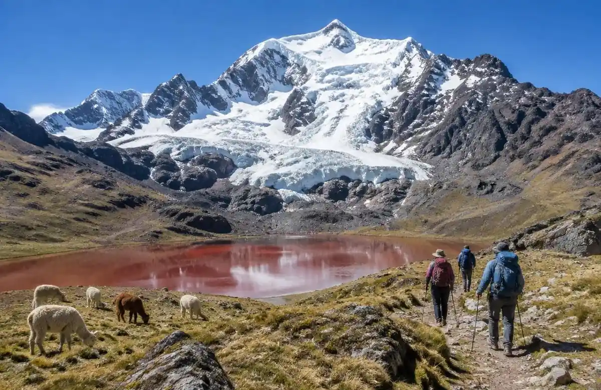
Each day has 5 to 7 hours of walking with camps between 4,400 m and 4,700 m. Distances and elevations are approximate and can change with weather and trail conditions.
Day 1: Cusco to Tinki and Upis hot springs
Early pickup and a 3.5 hour drive past Ocongate to Tinki (3,880 m). We start walking across open grassland with the first views of Ausangate and camp at Upis (4,400 m), where natural hot springs sit below the glacier. About 8 km, 3 hours.
Day 2: Arapa Pass and the red lagoons
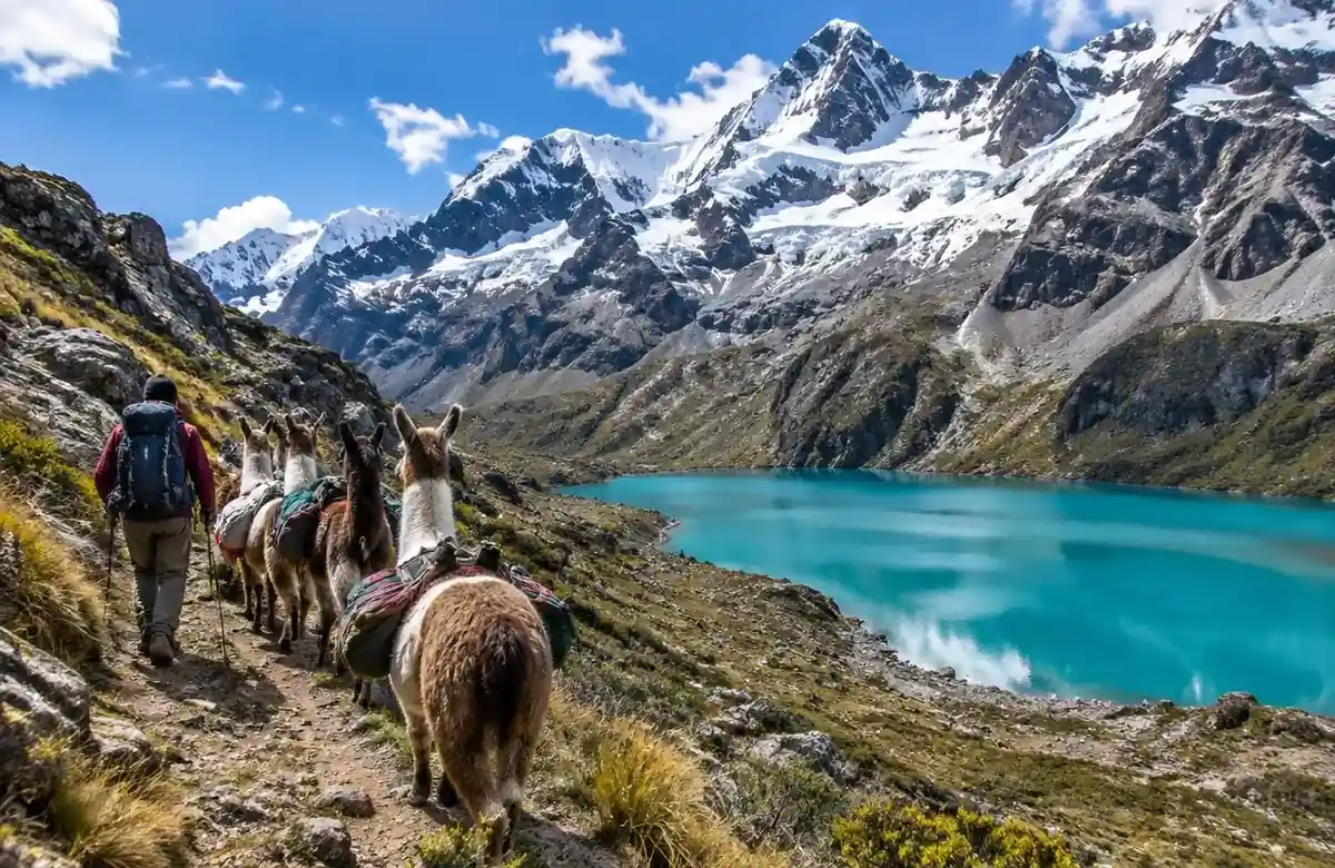
Climb to Arapa Pass (about 4,850 m), then descend past Pucacocha and other red and turquoise lagoons fed by the Ausangate glacier. Alpaca and llama herds graze here. Camp near the Vinicunca side of the range at about 4,600 m. About 15 km, 7 hours.
Day 3: Rainbow Mountain and Red Valley
We leave before dawn and reach the Rainbow Mountain viewpoint (5,036 m) before the day-tour groups arrive, then walk through the Red Valley. Afternoon walk to camp below Ausangate at about 4,700 m. About 13 km, 6 hours.
Day 4: Palomani Pass, the highest point
The hardest day. A steady climb to Palomani Pass at 5,200 m (17,060 ft), with glaciers close enough to hear them crack. Descend past Ausangatecocha lake to camp at about 4,500 m. About 14 km, 7 hours.
Day 5: Pacchanta hot springs and back to Cusco
An easy downhill walk to the village of Pacchanta, a soak in the hot springs, lunch, and the drive back to Cusco, arriving around 6 pm. About 10 km, 3 hours.
Ausangate Trek Map, Distance and Elevation
The Ausangate circuit is a loop of about 60 km on this 5-day route; the full traditional circuit without Rainbow Mountain is closer to 70 km over 5 to 6 days.
- Region: Vilcanota mountain range, Quispicanchi province, about 100 km southeast of Cusco
- Trail: unmarked in places, no roads or shops between villages
- No signal for most of the route; guides carry a radio or satellite device
| Point | Elevation | Day |
|---|---|---|
| Tinki (start) | 3,880 m / 12,730 ft | 1 |
| Upis hot springs camp | 4,400 m / 14,430 ft | 1 |
| Arapa Pass | about 4,850 m / 15,910 ft | 2 |
| Rainbow Mountain viewpoint | 5,036 m / 16,522 ft | 3 |
| Palomani Pass | 5,200 m / 17,060 ft | 4 |
| Pacchanta (finish) | 4,100 m / 13,450 ft | 5 |
How Hard Is the Ausangate Trek?
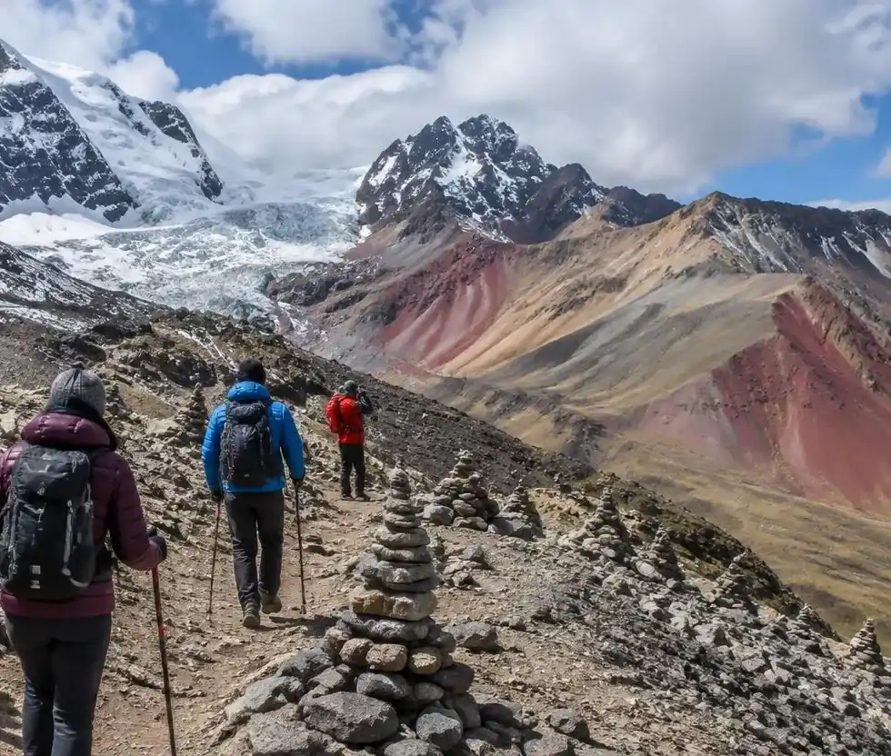
The Ausangate trek is hard because of altitude, not technical terrain: you sleep above 4,400 m every night and cross three passes near or over 5,000 m.
The trail itself has no climbing or ropes. Most people find day 4 the toughest. If you have done the Salkantay or Inca Trail and felt fine, you can do Ausangate with good acclimatization.
Acclimatization and altitude sickness
Spend at least 2 to 3 nights in Cusco (3,400 m) before starting, ideally with a day hike like Humantay Lake. Walk slowly, drink 3 to 4 liters a day and tell your guide early about headache or nausea. Emergency oxygen and a horse travel with every group.
Cold nights
Nights drop to -5 to -15°C (23 to 5°F) in the dry season. A warm sleeping bag, down jacket, hat and gloves matter more than anything else on this trek.
Who should not do this trek
First-time high-altitude hikers with no acclimatization time, people with heart or lung conditions, and anyone wanting comfortable lodges. Choose the Sacred Valley or a shorter trek instead.
Best Time to Hike Ausangate
The best time for the Ausangate trek is May to September, the dry season, with clear skies and the coldest nights.
| Months | Weather | Trekking |
|---|---|---|
| May to September | Dry, sunny days, freezing nights | Best |
| April, October, November | Some afternoon rain or snow | Good, with rain gear |
| December to March | Wet season, snow on passes | Hard, some departures cancelled |
Hot Springs on the Ausangate Trek
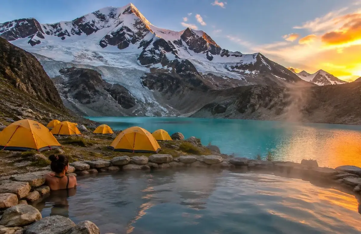
There are two hot springs on the route: Upis at the end of day 1 and Pacchanta on the last morning.
Upis is a small, simple pool next to camp with a direct view of the glacier. Pacchanta has several community-run pools and is the best place to soak tired legs before the drive back.
Mount Ausangate: Height and Meaning
Mount Ausangate, also called Nevado Ausangate, rises to 6,384 m (20,945 ft) and is the highest mountain in the Cusco region.
For Quechua communities it is Apu Ausangate, the most important mountain spirit of southern Peru, believed to bring water and protect herds. Every year thousands of pilgrims walk to its slopes for the Qoyllur Rit'i festival. The trek circles the mountain; it does not climb the summit, which is a technical mountaineering expedition.
Ausangate Trek with a Guide or Without
You can hike the Ausangate trek without a guide, but most visitors go guided because the trail is unmarked in places, weather changes fast, and the nearest road can be a day away.
| Guided | Independent | |
|---|---|---|
| Navigation | Guide knows the route | GPS track and map needed |
| Gear | Horses carry tents and food | You carry 15 kg or more |
| Safety | Oxygen, horse, radio | On your own |
| Logistics | Transport and fees handled | Bus to Tinki, pay fees in cash |
Ausangate Trek vs Salkantay Trek vs Inca Trail
Choose Ausangate for the highest and wildest scenery, Salkantay for a trek that ends at Machu Picchu, and the Inca Trail for Inca ruins on the way.
| Ausangate | Salkantay | Inca Trail | |
|---|---|---|---|
| Highest point | 5,200 m | 4,630 m | 4,215 m |
| Permit | Not needed | Not needed | Needed, sells out |
| Ends at Machu Picchu | No | Yes | Yes |
| Crowds | Very few | Moderate | Busy |
| Difficulty | Challenging | Moderate to challenging | Moderate |
Ausangate Trek Packing List
- Sleeping bag rated to -10°C / 14°F
- Down jacket, fleece, thermal base layers
- Waterproof jacket and pants
- Broken-in hiking boots and warm socks
- Warm hat, sun hat, gloves
- Sunglasses, SPF 50 sunscreen and lip balm
- Headlamp with spare batteries
- 2 water bottles and purification tablets
- Swimsuit and small towel for the hot springs
- Cash in small soles for tips and snacks
Ausangate Trek with Rainbow Mountain, 5 Days Reviews
“Rainbow Mountain was the reason we first looked at this trip, but the Ausangate Trek ended up being even more impressive. Five days of huge mountain views, quiet trails and changing landscapes made this feel like a real Peru adventure.”
Verified Traveler
“If you want more than a quick Rainbow Mountain day tour, this 5 day Ausangate Trek is a completely different experience. We had time to enjoy the scenery, hike through remote areas and see much more of the Andes.”
Verified Traveler
“The combination of Ausangate and Rainbow Mountain was exactly what we were looking for. The route was challenging in places, but every difficult section was rewarded with incredible views. Our guide handled the pace very well.”
Verified Traveler
“We had already visited Machu Picchu and wanted a different kind of trekking experience in Peru. The Ausangate Trek with Rainbow Mountain gave us remote landscapes, high-altitude hiking and some of the best mountain scenery of our entire trip.”
Verified Traveler
“This was definitely not an easy hike, but it was worth it. The 5 day Ausangate trekking route felt wild and peaceful, and reaching Rainbow Mountain as part of a longer journey was much more satisfying than simply arriving for a short visit.”
Verified Traveler
“For hikers who enjoy less crowded trails, I would highly recommend the Ausangate route. We saw dramatic mountains, beautiful valleys and very few other groups during parts of the trek. Rainbow Mountain was an amazing bonus.”
Verified Traveler
Ausangate Trek with Rainbow Mountain, 5 Days: FAQs
Where is the Ausangate trek?
The Ausangate trek is in the Vilcanota mountains of the Cusco region of Peru, about 100 km southeast of Cusco, starting from the villages of Tinki and Upis.
How long is the Ausangate trek?
Our route is about 60 km over 5 days. The full traditional circuit is about 70 km and takes 5 to 6 days; short versions with Rainbow Mountain take 3 to 4 days.
How high is the Ausangate trek?
The highest point is Palomani Pass at 5,200 m (17,060 ft). Camps are between 4,400 m and 4,700 m.
How hard is the Ausangate trek?
It is challenging because of the altitude and cold, not because of technical terrain. Fit hikers who acclimatize in Cusco first can do it.
Do you need a permit for the Ausangate trek?
No. Unlike the Inca Trail, no government permit is needed. Local communities charge small fees, which are included in our price.
Can you do the Ausangate trek without a guide?
Yes, experienced hikers can do it independently with a GPS track and full camping gear, but the route is remote and partly unmarked, so a guide is safer.
Does the Ausangate trek include Rainbow Mountain?
Yes. On day 3 we reach the Rainbow Mountain viewpoint early in the morning from the quiet side, plus the Red Valley.
When is the best time for the Ausangate trek?
May to September, the dry season. December to March brings rain and snow on the passes.
How cold is the Ausangate trek?
Daytime is often 10 to 15°C in the sun, but nights fall to -5 to -15°C in the dry season.
How high is Mount Ausangate?
Mount Ausangate is 6,384 m (20,945 ft), the highest peak in the Cusco region.
What does Ausangate mean?
Ausangate is a Quechua name for the sacred mountain; locals call it Apu Ausangate, the protector spirit that brings water to the valleys.
Can I ride a horse on the Ausangate trek?
Horses carry the group gear, and an emergency horse travels with every group so you can ride if you feel unwell.
Is the Ausangate trek worth it?
For fit hikers who want glaciers, wildlife and almost no crowds, yes. It is one of the most scenic treks in Peru, but it does not end at Machu Picchu.